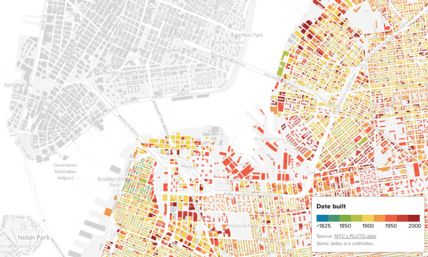
The folks at BRLYNR, a Brooklyn-obsessed blog, are really good at innovative and informative maps. They’ve made a map about journalism coverage neighborhood by neighborhood, a map about the most dangerous bike routes, and now, an interactive map that uses color to depict when every building in Brooklyn was built.
Block By Block: Brooklyn’s Past and Present is this week’s Best Link Ever, and in our opinion, the best map they’ve made to date. Zoomed out, you can see a lot of yellow, the color assigned for buildings built around 1900. Zooming in, neighborhoods like Bed-Stuy reveal buildings from the late 1800s while Brooklyn Heights holds a high concentration of properties from the 1840s and ‘50s. If color isn’t your thing, don’t worry: when your mouse scrolls over a building its address and precise date of construction appears in the top right corner of the screen.
If you love Brooklyn, this map is terribly, terribly addictive. So long, productivity!


Comments on this entry are closed.